
Airport Urban District, Santa Bárbara, Seville
Santa Bárbara reconsidered as a neighbourhood and an employment hub beside the airport
How do you revive a twenty-year-old plan so that growth beside the airport brings together housing, employment and parks?
The revision keeps the green structure of the original plan and reorganises it around four criteria: competitiveness, identity, connectivity and liveability. Housing and employment share the district, and the motorway that crosses it becomes a tree-lined boulevard that closes Seville's green ring.
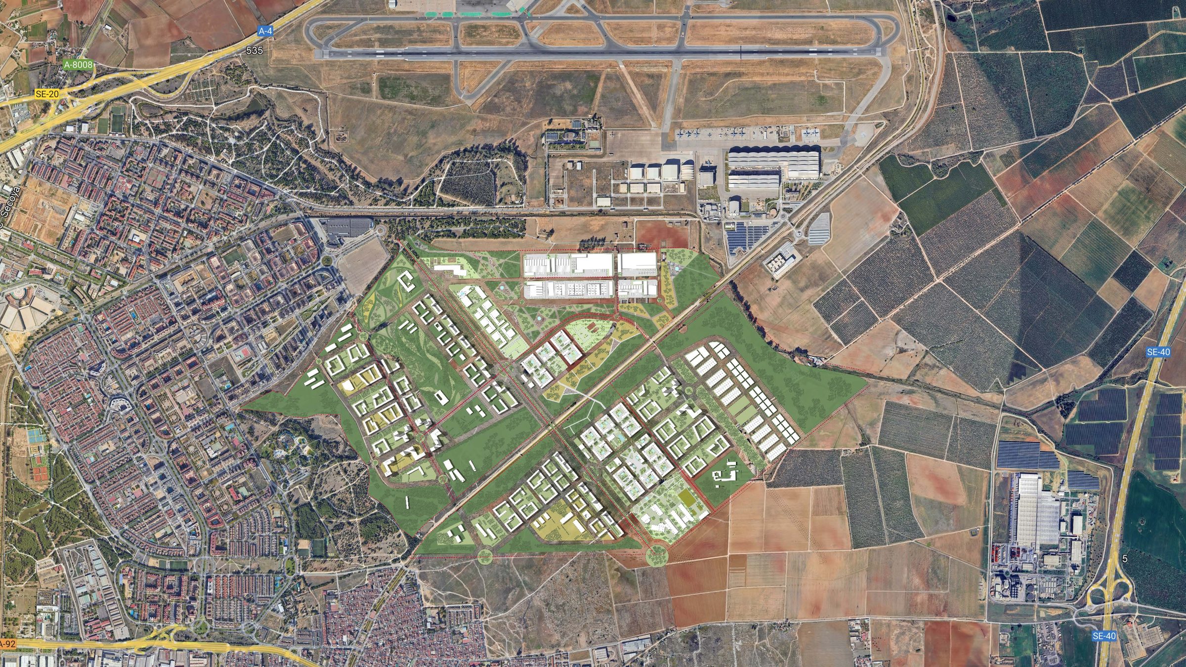
EDDEA has been working in Santa Bárbara since 2002, when it planned this land in the east of Seville for DUSE, part of Grupo Sando; in 2019 it took it up again for Criteria Caixa with the Partial Plans (Planes Parciales) for sectors 4 and 5: 168 hectares right beside San Pablo airport. In 2023 that plan was revised under a new name, the Airport Urban District (Distrito Urbano Aeroportuario): land that the General Plan had earmarked for a large residential extension is now planned in relation to the aeronautical activity that has grown up around it.
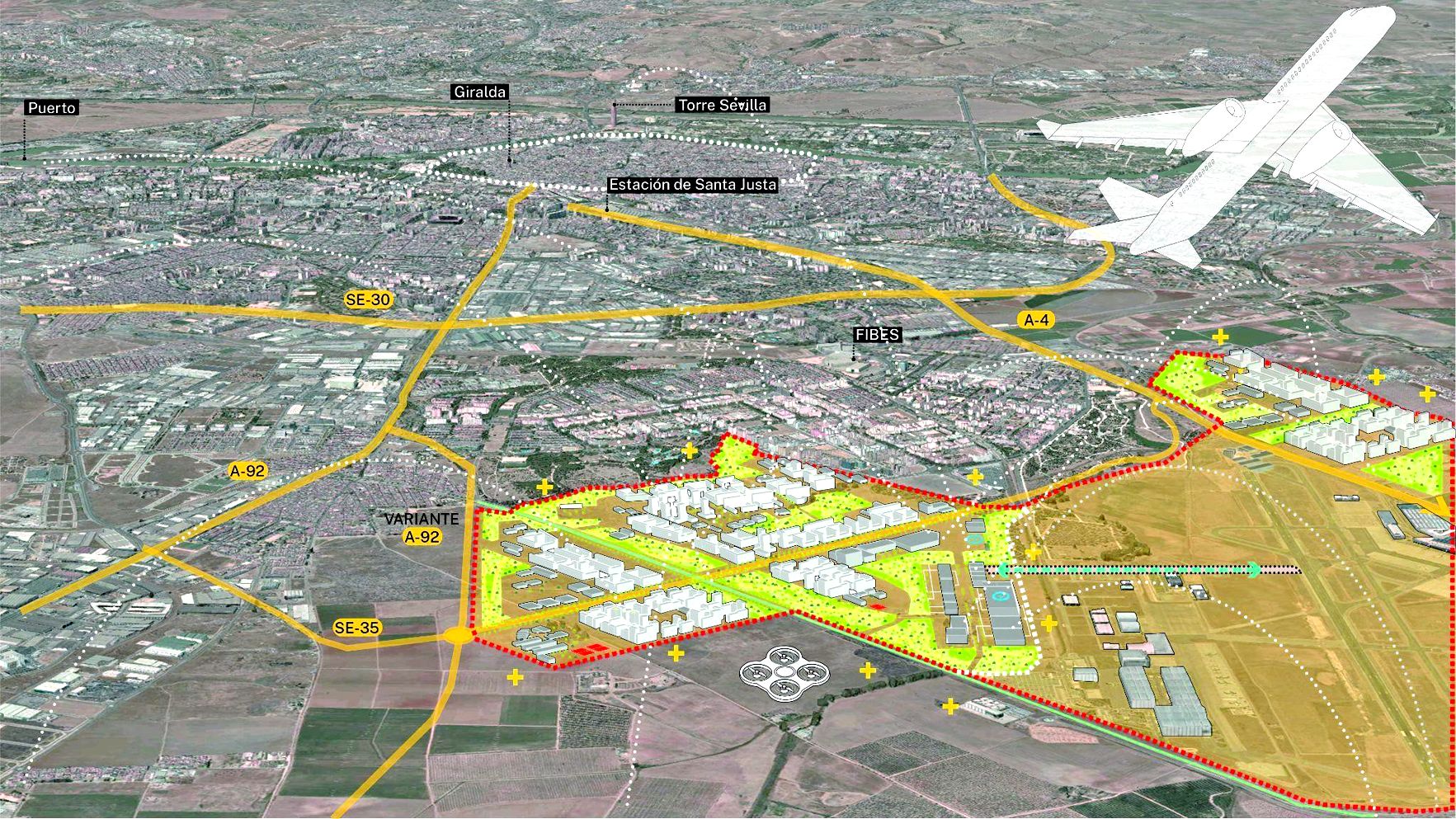
EDDEA's approach is the origin of the Aerospace District announced by Seville City Council in 2025: some 1,000 hectares around the airport, Airbus and Aerópolis, with more than 800,000 m² of industrial and logistics land in a first phase and up to 24,000 homes in the medium term. Santa Bárbara is its central core.
From the 2003 idea to the 2023 idea
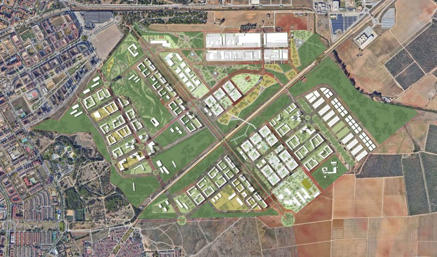
The revision compares two ideas. The 2003 scheme, born of the General Plan, divided the area into five residential and economic-activity sectors around the Canal del Bajo Guadalquivir park. The 2023 scheme keeps that green structure and reorganises it according to four guiding criteria – competitiveness, identity, connectivity and liveability – so that the district works at once as an employment hub tied to the airport and as a neighbourhood.
Sectors 1 to 4 are residential. Sector 5 brings together the economic activities: 861,020 m² of land and 430,510 m² of floor area for businesses, next to the runway and the aeronautical factory, so that work lies within walking distance of home.
A motorway turned into a boulevard
The planned route of the SE-35 cuts diagonally across the district. The proposal turns it into the “SE-Verde”, a great boulevard with more trees, a cycle lane, footpaths and fewer traffic lanes, which ties the sectors together and closes Seville's green ring to the east.
Housing and green space in equal measure
The scheme provides for 14,806 homes, 40% of them subsidised, and devotes another 40% of the land to green space. As in the original plan, the housing occupies the interstices of the open-space system: the canal park at the scale of the city, the parks of each neighbourhood and the pedestrian spines that run through the blocks and bring greenery right up to the front doors.
The first developments are already being designed within the area, among them the 313 homes EDDEA is designing for Vía Ágora in sector 1, facing one of those green spines.
Unlocking the strategic infrastructure
The district depends on infrastructure that goes beyond the scope of any single sector: the ring road, the large parks and the tram and Metro Line 2 connections to the airport. The 2006 Preliminary Plan (Avance) already identified their delivery as the condition for bringing the land into use, and the 2023 revision has brought it to the fore. With the consensus of the stakeholders involved and the proposal submitted to the City Council, work now focuses on unlocking these general systems (sistemas generales) so that the sectors develop with their parks and transport in place from day one.
The project in the press
- Seville plans a 24,000-home neighbourhood to grow eastwards, crossed by the future SE-35 — El Español (Sevilla)
- Seville presents the new Aerospace District with 24,000 homes and industrial land — Canal Sur
- Seville launches an ambitious Aerospace District with 10 million square metres and 24,000 new homes — Sevilla Negocios
- The newly created aerospace district includes 24,000 homes and 800,000 square metres of industrial land — NoticiasDe.es